
3 Hikes within 3 Hours of Washington D.C.

Did you move to Washington D.C. in the past few years? Are you outdoorsy? By now, you’ve probably hiked local favorites like Great Falls, Annapolis Rock and Harpers Ferry. Or maybe you splurged on an annual pass at Shenandoah National Park. But that’s not all the DMV has to offer.
If you’re looking for budget friendly alternatives close to the city, here are three amazing hikes within three hours of D.C.!

Seneca Rocks
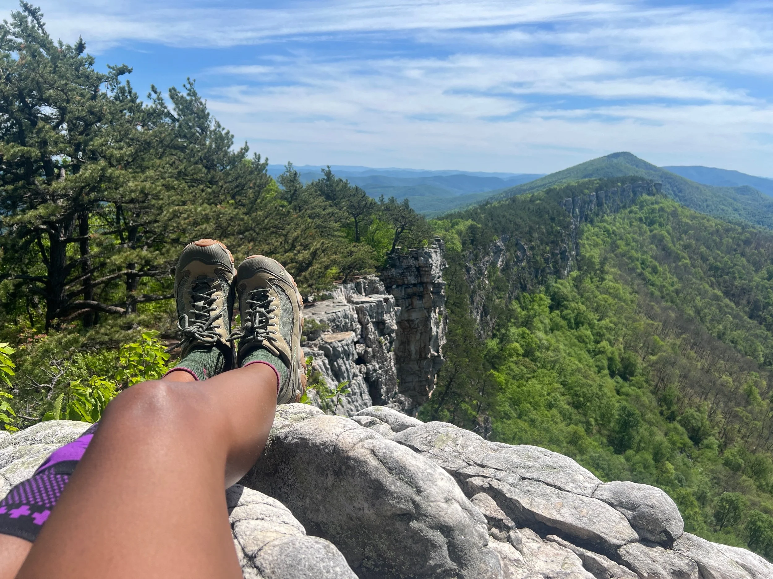
Seneca Rocks is a 3.6 mile hike in Monongahela National Forest, only a 3-hr drive from Washington D.C. This popular West Virginia landmark rises 839 ft above the North Fork South Branch Potomac River. By the end of my hike, all I wanted to do was chuck my shoes and sink my feet into the cool water.
To start, search for Seneca Rocks Discovery Center on Google or Apple Maps. The drive alone is beautiful and makes this hike worthwhile. There’s also an observation deck with binoculars where you can watch climbers high above on the jagged rocks. I recommend topping off your water and using the restroom inside before you start your hike.
The trail picks up behind the building. The trail skirts a meadow, perfect for snapping a few photos of the rock formation, and then crosses the climbers parking lot. Walk towards the bridge over the North Fork and take a mental picture to motivate you later on. Then walk along Roy Gap Road until you see signs for Seneca Rocks trail. From there, the trail is well-marked and easy to follow.
The first section is a pretty leisurely stroll through the forest with plenty of shade. The trail is well-maintained with lots of signage to educate hikers about local fauna and trail erosion. I immediately noticed deer bounding across the path and felt my worries fall away–at least for the moment. There was running water, lots to look at and enjoy, and a few earthen staircases to tackle.
The second section consists of long switchbacks. The incline is gradual and the hike still feels enjoyable. The third section of the hike included more staircases (stone) leading up to the overlook. The overlook includes a viewing platform with beautiful views of the valley below and distant peaks. Slightly above the platform is a sign cautioning hikers to proceed at their own risk to the rock scramble above. Fifteen people have fallen to their deaths from Seneca Rocks since the 1970s, and while it's unclear how many were hikers versus climbers, it’s still a sobering number.
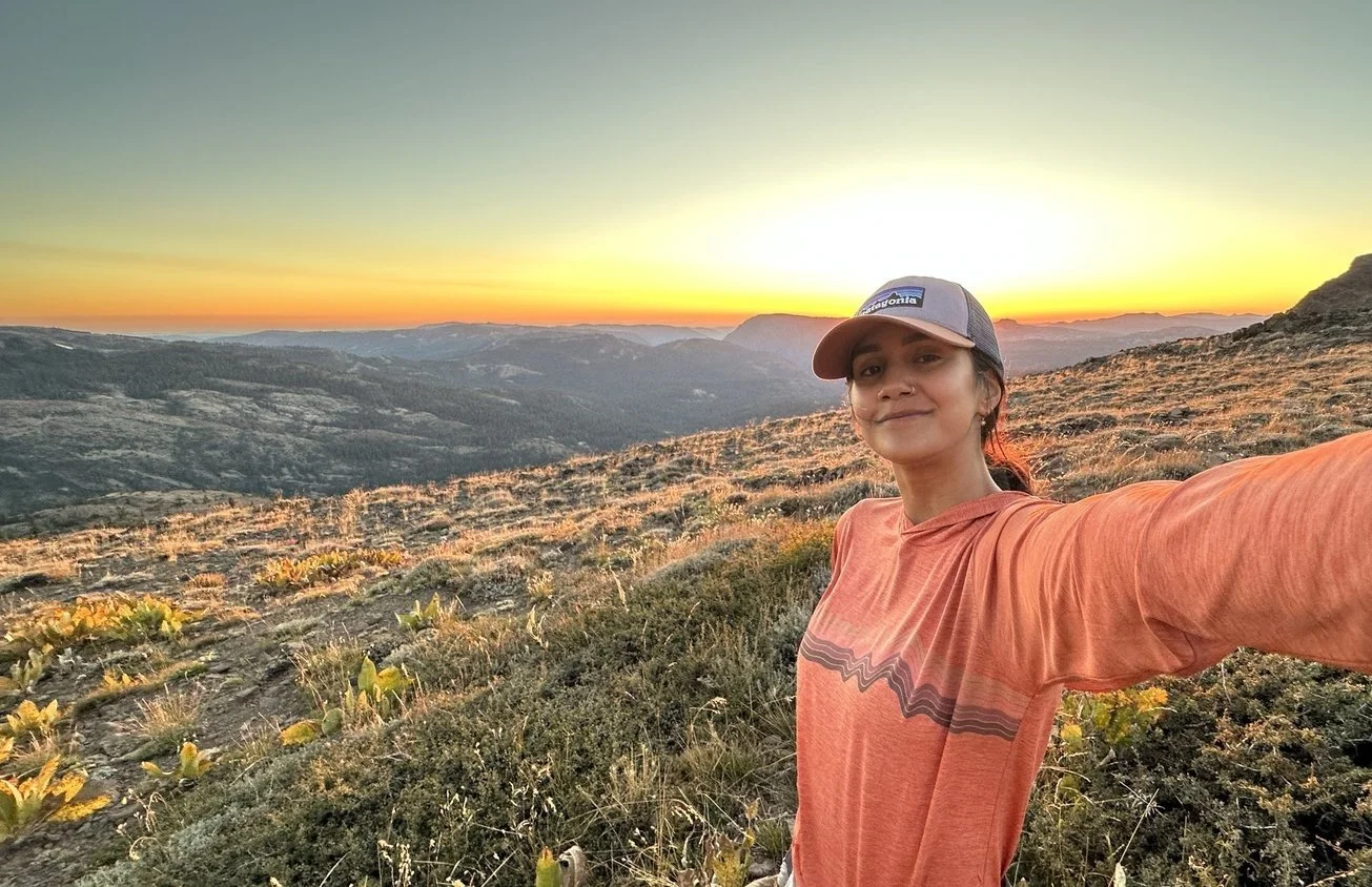
After reading the sign, I completed the rock scramble. There was a mix of adults and kids (including preschoolers with a 1:1 parent to child ratio) keeping me company. Another reminder that many kids are natural pros at rock scrambling while many adults are not. I’m in the second category so I was definitely taking notes and doing my best to stay low and parallel to the rock. The view up top was amazing. It wasn’t that different from the viewing platform but it felt different, maybe because it was framed by rock, sky, distant peaks and nothing else. I went on a Saturday but there were few people at the viewing platform and even fewer on the rock scramble above.
@utena86 Seneca Rocks is a 3-mile hike in Monongahela National Forest, only a 3-hr drive from DC. Park at the Seneca Rocks Discovery Center and top off your water/use the restroom inside before picking up the trail behind the building. It’s well marked. At the overlook, enjoy the beautiful view from the platform or try the rock scramble AT YOUR OWN RISK for another amazing view of the valley below. #DMVTikTok #BlackGirlsHike #SenecaRocks #DiversifyOutdoors ♬ coming of age - natalie
Pets.
Dogs are allowed.
Fees.
This hike is free. Parking is also free.
Accessibility.
While the Seneca Rocks overlook trail isn’t accessible for wheelchair users there is a separate wheelchair accessible trail behind the discovery center that comes with plenty of shade, a footbridge and educational signage. This hike gets extra points for having disabled parking spots, restrooms, water and interpretive forest rangers on-site.
Things to know before you go.
There isn’t much cell signal in the area. So reverse your route and copy it into the notes section of your phone.
Should you hike here as a person of color?
I felt extremely comfortable here as an African American woman. This is not a backcountry hike, it is a well maintained trail with a Forest Service discovery center, rangers, parking, lots of local and out-of-state hikers and climbers. I saw two other Black hikers–both women along with Asian and Latine families on the trail with their kids.
Most people were very friendly. I’m an outgoing hiker by nature but I also read the room.
I did not stop to get gas along the way but I would’ve felt comfortable doing so at any of the larger service stations.

Buzzard Rock
Buzzard Rock is a 3.6 mi hike in the George Washington and Jefferson National Forest, a 1.5 hr drive from Washington DC. It’s an out-and-back hike with 660 ft of elevation gain. The trailhead parking lot is off state route 619 in Front Royal, Virginia, close to the northern entrance of Shenandoah National Park.
There are fallen trees and overgrown sections of trail. There are a few stream crossings so prepare to get your feet wet. The path widens and becomes extremely rocky as it slowly climbs towards the overlook. The trail was well-marked and relatively easy to follow. There was only one slightly confusing intersection where I had to consult AllTrails. Someone had fashioned an arrow out of sticks that also pointed out the right way to go.
Buzzard Rock has two main overlooks. The first overlook is a good resting point before the final ascent. There are no benches, but there is a picturesque view of the valley below and a nearby fish hatchery. The main overlook faces a pine-filled ridgeline. This hike doesn’t have a sweeping majestic view and the valley below is narrow but it’s still a beautiful view. The overlook also has a rock scramble for the more adventurous folks.
@utena86 The hole in the wall of hikes! Make sure you grab food at Spelunkers afterwards. #Virginia #Hiking #DMVTikTok #WLWTikTok #Sapphic #BlackGirlsHike ♬ Little Things - Adrián Berenguer
How to get there
Search for Buzzard Rock Trail on Apple Maps and Buzzard Rock Parking Area on Google Maps.
The gravel parking lot is right off a state highway but blink and you’ll miss it.
Pets.
Leashed dogs are allowed.
Fees
This hike is free. Parking is also free.
Accessibility
This trail is not accessible to wheelchair or rollator users. There are no amenities outside of a small gravel parking lot. The nearest bathroom is 10-15 mins away in town.
Wildlife
I worried more about coming across wildlife since some sections of trail are extremely overgrown but I didn’t even see deer—just a tired rat snake coiled in the hollow of a tree.
Should you hike here as a person of color?
I wasn’t sure how to feel after hiking this trail twice as a Black woman. The overlook is beautiful and the trail was quiet and peaceful. So I’m mostly referring to the social aspect. Buzzard Rock is more of a local spot that white hikers with access and knowledge share with people who look like them. It hasn’t really blown up on social yet, so don’t expect to see diverse hikers.
I will say this. If you are Black and want to enjoy Buzzard Rock, I recommend bringing a friend. Bring a friend with you. And enjoy! It’s a beautiful hike.

Catoctin Mountain
Catoctin Mountain trail is a 9-mile loop with about 1,600 ft of elevation gain. It’s located in Catoctin Mountain Park, a 1-hr drive north of Washington DC. There are a few steep inclines but much of the terrain slopes gradually, although it’s often slow-going due to large roots, loose rock and gravel. The extended loop covers the following: Hogs Rock, Falls Nature Trail, Blue Ridge Summit, Thurmont Vista, Wolf Rock and Chimney Rock. However, it’s possible to shorten your hike by cutting out certain overlooks. Or pencil in a long walk through the woods for your next free Saturday.
It’s quiet and serene during early morning hikes. The trail gets busier towards late morning on the weekends. On weekday mornings, it draws local hikers and retirees. If you’re looking to be fully immersed in nature and you don’t want to drive far, this is your chance. The trail system is large enough that you can plan your own hike.
I recently hiked the 9 mi loop with an acquaintance. Since then I’ve come back several times to do shorter 4.5 mile hikes. My favorite overlooks are the most popular ones. Wolf Rock, a rock scramble with several deep crevasses and a formation in the shape of a wolf’s head, is a good spot to eat lunch or simply enjoy the view. Chimney Rock is a slightly more challenging rock scramble with a few tricky moves—I’m 6’1” and needed help in one or two places. But you can also just relax on a boulder and enjoy Nature.
@utena86 Shaky leg! 🫣 Not built for rock scrambling but doing my best 🙋🏾♀️ #HikingAdventures #HikingTikTok #DMVTikTok #GetOutside #Senderismo #BlackGirlsHike ♬ original sound - will paquin
How to get there
Search for Catoctin Mountain Visitors Center and park in the lot. There are restrooms inside, however, the center doesn’t open until 9am. The trail begins at one end of the parking lot. You can hike clockwise or counterclockwise. Trail intersections are well marked.
Fees
This hike is free. Parking is also free.
Pets.
Leashed dogs are allowed.
Wildlife
According to the National Park Service, Catoctin’s nearly 6,000 acres are home to 280 animal species, including black bears, turkeys and deer. The rock scramble areas also have signage warning about rattlesnakes. I enjoy hiking at the park and I’ve seen none of the above.
Accessibility
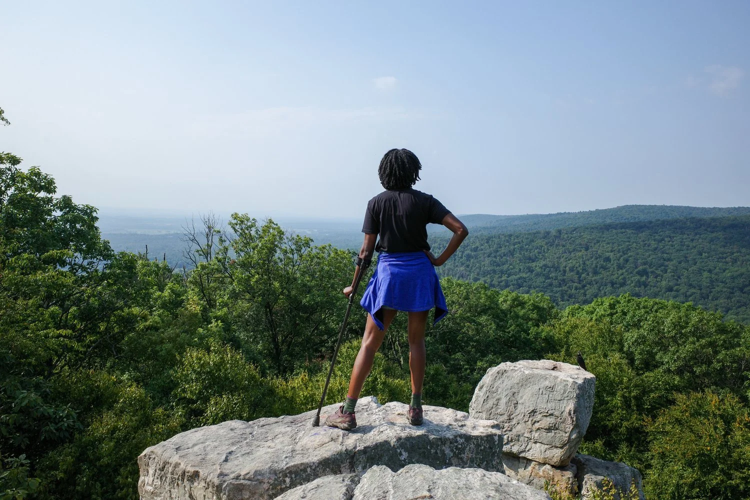
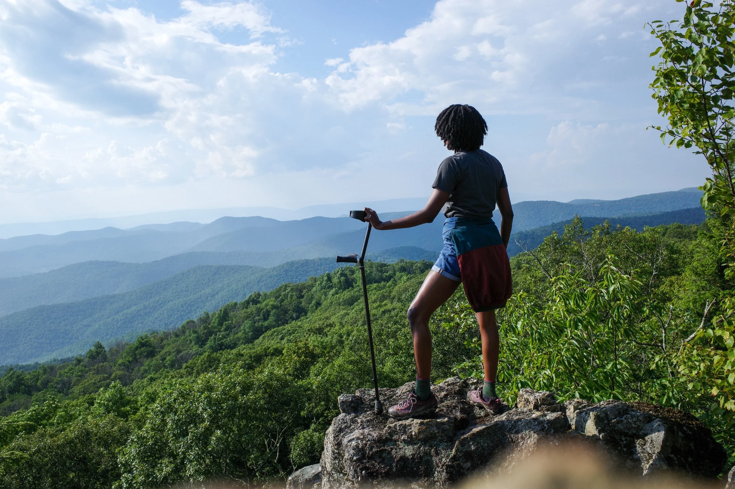
Wheelchair accessible areas at Catoctin are listed on the National Park service website. However, this hike isn't one of them. As an elbow crutch user, I found the downhills to be challenging due to loose rocks and steep terrain. There are a few benches which makes it more accessible for anyone who likes to take breaks while hiking.


We kicked off from the South Kaibab Trailhead at 4:30 AM, in the dark, our headlamps lighting the way. The morning was cool—perfect hiking weather—and the sky was just starting to hint at the sunrise. The trail drops fast, and within minutes we weaved our way down steep switchbacks, passing early-bird day hikers and the occasional runner already charging uphill.